


by
, , , , , and

Climate 2023, 11(9), 182; https://doi.org/10.3390/cli11090182 - 30 Aug 2023
Abstract
Rapid urbanization and climate change effects may cause dramatic changes in ecosystem functions in cities, thereby inevitably affecting the growth performance of old trees. Few studies have explored species diversity and spatial differentiation in Benin urban areas. This study aims to explore this
[...] Read more.
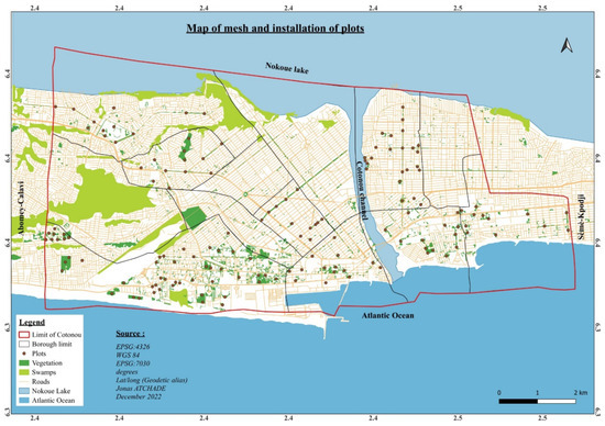
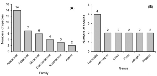
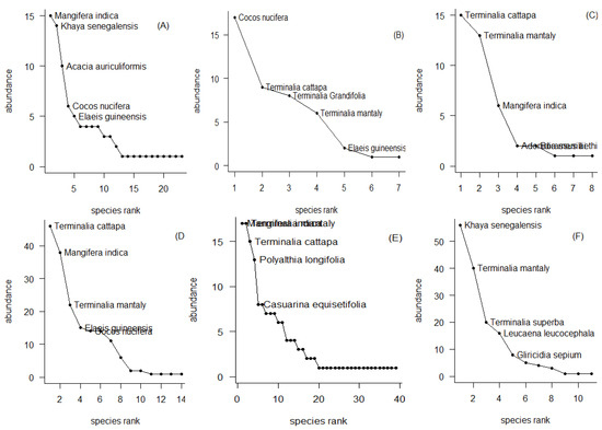
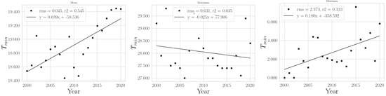
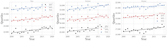
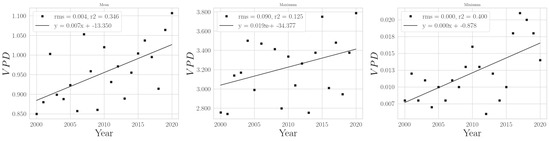
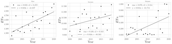
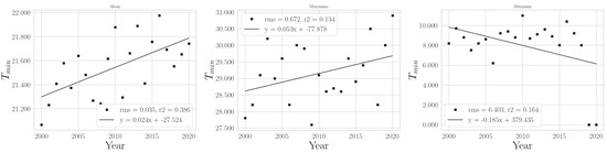
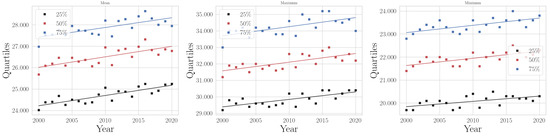
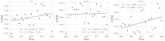
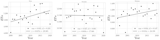
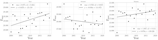
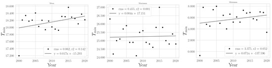
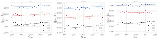
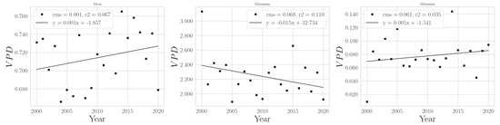
Rapid urbanization and climate change effects may cause dramatic changes in ecosystem functions in cities, thereby inevitably affecting the growth performance of old trees. Few studies have explored species diversity and spatial differentiation in Benin urban areas. This study aims to explore this dimension of urban ecology in order to build resilience to climate change in the city of Cotonou. Its objective was to determine the predominant level of tree diversity in the city’s land use units. The urban green frame was subdivided into six land use units, namely, establishments, residences, green spaces, commercial areas, administrative areas, and roads. The forest inventories were carried out in 149 plots with surfaces evaluated at 2500 m2 each. The IVI, an index that highlights the relative density, relative dominance, and relative frequency of species, has been used to characterize the place occupied by each species in relation to all species in urban ecosystems. This shows ecological importance through the diversity and quality of ecosystems, communities, and species. A total of 62 tree species in 55 genera and 27 families were recorded. The results show that the flora of the city of Cotonou is characterized by a strong preponderance of exotic species with some differences in species presence. The most abundant species with high ecological importance (IVI) in the different types of land use of the city are Terminalia catappa (IVI = 121.47%), Terminalia mantaly (IVI = 90.50%), Mangifera indica (IVI = 64.06%), and Khaya senegalensis (IVI = 151.16%). As the use of ecosystem services is recommended to tackle urban climate hazards, this study shows that direct development of this urban vegetation could improve the resilience of urban life to climate hazards through the provision of urban ecosystem services, potential ecological infrastructure foundations, and urban nature-based solutions.
Full article
(This article belongs to the Special Issue Climate System Uncertainty and Biodiversity Conservation)
►
Show Figures
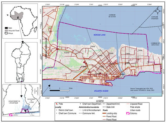
Figure 1


