by
and

Coasts 2023, 3(3), 227-239; https://doi.org/10.3390/coasts3030014 - 30 Aug 2023
Abstract
►
Show Figures
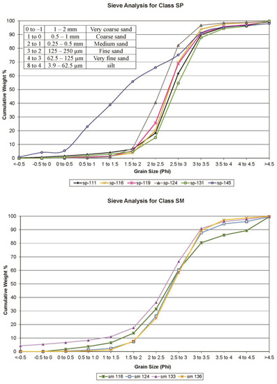
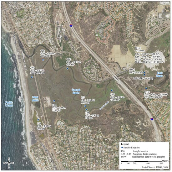
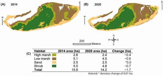
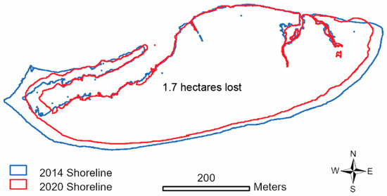
The San Elijo Lagoon experienced a sudden shift in sedimentation type around 1000 AD, as evidenced by the 14C dating. This shift is marked by a sharp boundary between a lower layer of medium to fine sand and an upper layer of
[...] Read more.
The San Elijo Lagoon experienced a sudden shift in sedimentation type around 1000 AD, as evidenced by the 14C dating. This shift is marked by a sharp boundary between a lower layer of medium to fine sand and an upper layer of dark, silty clay that reflects the lagoon closure. The dated sediments also reveal a history of marine conditions in the lagoon basin since about 7400 ± 140 years before the present (ybp), when the sea level was −12.2 meters (m), and the shoreline was 400 m away from the current location. The sea level rose at a rate of 2.84 m per 1000 years until about 4170 ± 100 ybp. After that, the rising sea level slowed and reached the present level about 3100 years ago. However, the lagoon remained closed after about 730 to 1180 ybp, with only fine organic sediment accumulating in the basin, which coincides with a severe drought in the southwest around 1150 AD. A higher sedimentation rate is interpreted from bluff erosion as seen after 520 ± 40 ybp but without enough stream flow to force the reopening of the lagoon.
Full article
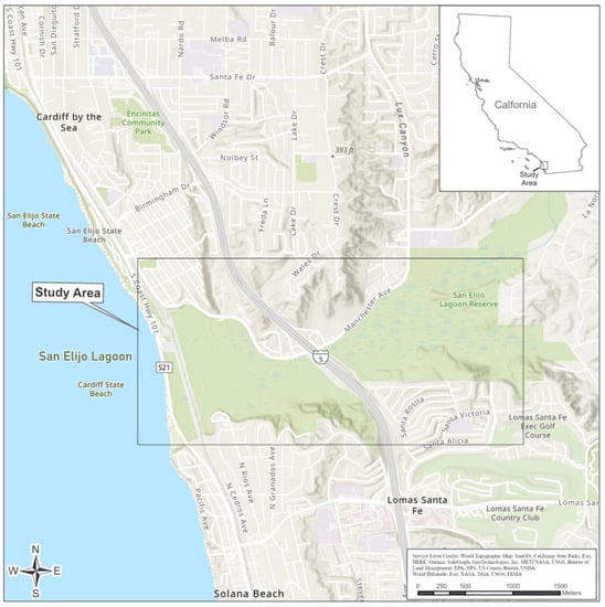
Figure 1


